Hoover Dam
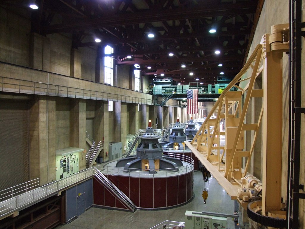
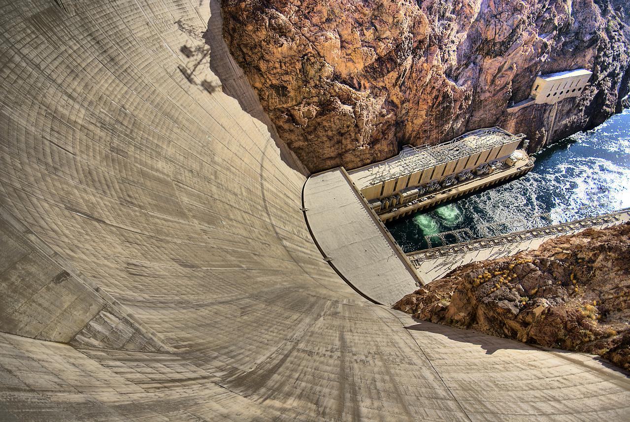
Hoover Dam, also sometimes known as Boulder Dam, is a concrete arch-gravity dam in the Black Canyon of the Colorado River, on the border between the U.S. states of Arizona and Nevada. When completed in 1935, it was both the world's largest electric-power generating station and the world's largest concrete structure. It was surpassed in both these respects by the Grand Coulee Dam in 1945. It is currently the world's 35th-largest hydroelectric generating station.
This dam, located 30 miles (48 km) southeast of Las Vegas, Nevada, is named after Herbert Hoover, who played an instrumental role in its construction, first as the Secretary of Commerce and then later as the President of the United States. Construction began in 1931 and was completed in 1935, more than two years ahead of schedule. The dam and the power plant are operated by the Bureau of Reclamation of the U.S. Department of the Interior. Listed on the National Register of Historic Places in 1981, Hoover Dam was designated a National Historic Landmark in 1985.
This dam, located 30 miles (48 km) southeast of Las Vegas, Nevada, is named after Herbert Hoover, who played an instrumental role in its construction, first as the Secretary of Commerce and then later as the President of the United States. Construction began in 1931 and was completed in 1935, more than two years ahead of schedule. The dam and the power plant are operated by the Bureau of Reclamation of the U.S. Department of the Interior. Listed on the National Register of Historic Places in 1981, Hoover Dam was designated a National Historic Landmark in 1985.

To protect the construction site from flooding, two cofferdams were constructed. Construction of the upper cofferdam began in September 1932, even though the river had not yet been diverted. A temporary horseshoe-shaped dike protected the cofferdam on the Nevada side of the river. After the Arizona tunnels were completed, and the river diverted, the work was completed much faster. Once the coffer dams were in place and the construction site dewatered, excavation for the dam foundation began. For the dam to rest on solid rock, it was necessary to remove all the riverbed's accumulated erosion soils and other loose materials until sound bedrock was reached. Work on the foundation excavations was completed in June 1933. During excavations for the foundation, approximately 1,500,000 yd³ (1,150,000 m³) of material was removed. Since the dam would be a gravity-arch type, the side-walls of the canyon would also bear the force of the impounded lake. Therefore the side-walls were excavated too, to reach virgin (un-weathered) rock which had not experienced the weathering of centuries of water seepage, wintertime freeze cracking, and the heating/cooling cycles of the Arizona/Nevada desert.

To divert the river's flow around the construction site, four diversion tunnels were driven through the canyon walls, two on the Nevada side and two on the Arizona side. These tunnels were 56 feet in diameter. Their combined length was nearly 16,000 feet (4877 meters, more than three miles). Tunneling began at the lower portals of the Nevada tunnels in May 1931. Shortly afterwards, work began on two similar tunnels in the Arizona canyon wall. In March 1932, work began on lining the tunnels with concrete. First the base or "invert" was poured.
Gantry cranes, running on rails through the entire length of each tunnel were used to place the concrete. The sidewalls were poured next. Movable sections of steel forms were used for the sidewalls. Finally, using pneumatic guns, the overheads were filled in. The concrete lining is three feet (91.5 centimeters) thick, reducing the finished tunnel diameter to 50 feet (15.25 m).
Following the completion of the dam, the entrances to the two outer diversion tunnels were sealed at the opening and half way through the tunnels with large concrete plugs. The downstream halves of the tunnels following the inner plugs are now the main bodies of the spillway tunnels. The spillways can be seen directly above the outer diversion tunnels. They drop sharply from their entrance point and merge directly into the old diversion tunnels.
The two inner diversion tunnels have two concrete plugs in them. One is roughly half way along their length, and the other is around 75% of the way along their length. The section sandwiched between two concrete plugs is used as part of the tunnel which water travels along, to journey from the outermost intake towers and the generators. The two innermost intake towers have separate tunnels.
Gantry cranes, running on rails through the entire length of each tunnel were used to place the concrete. The sidewalls were poured next. Movable sections of steel forms were used for the sidewalls. Finally, using pneumatic guns, the overheads were filled in. The concrete lining is three feet (91.5 centimeters) thick, reducing the finished tunnel diameter to 50 feet (15.25 m).
Following the completion of the dam, the entrances to the two outer diversion tunnels were sealed at the opening and half way through the tunnels with large concrete plugs. The downstream halves of the tunnels following the inner plugs are now the main bodies of the spillway tunnels. The spillways can be seen directly above the outer diversion tunnels. They drop sharply from their entrance point and merge directly into the old diversion tunnels.
The two inner diversion tunnels have two concrete plugs in them. One is roughly half way along their length, and the other is around 75% of the way along their length. The section sandwiched between two concrete plugs is used as part of the tunnel which water travels along, to journey from the outermost intake towers and the generators. The two innermost intake towers have separate tunnels.

The large spillway tunnels have only been used three times in the history of the dam. The first one was during the second half of 1941 for testing. The second one was for about six weeks during the summer of 1983, when record precipitation and snow-melt in the Colorado River basin drained into Lake Mead, and the third one in 1999, again with heavy precipitation that filled Lake Mead.
The first concrete was placed into the dam on June 6, 1933. Since no structure of the magnitude of the Hoover Dam had been constructed, many of the procedures used in construction of the dam were untried. Since concrete heats up and contracts as it cures, uneven cooling and contraction of the concrete posed a serious problem. The Bureau of Reclamation engineers calculated that if the dam were built in a single continuous pour, the concrete would have taken 125 years to cool to ambient temperature. The resulting stresses would have caused the dam to crack and crumble. To solve this problem the dam was built in a series of interlocking trapezoidal columns. Each pour was no more than six inches deep. Because of this depth it is extremely unlikely that construction workers were accidentally buried alive in the concrete, contrary to popular folklore. To further cool the concrete each form contained cooling coils of 1 inch (25.4 mm) thin-walled steel pipe. River water was circulated through these pipes to help dissipate the heat from the curing concrete. After this, chilled water from a refrigeration plant on the lower cofferdam was circulated through the coils to further cool the concrete. After each layer had sufficiently cooled the cooling coils were cut off and pressure grouted by pneumatic grout guns. The concrete is still curing and gaining in strength as time goes on. There is enough concrete in the dam to pave a two-lane highway from San Francisco to New York.
The first concrete was placed into the dam on June 6, 1933. Since no structure of the magnitude of the Hoover Dam had been constructed, many of the procedures used in construction of the dam were untried. Since concrete heats up and contracts as it cures, uneven cooling and contraction of the concrete posed a serious problem. The Bureau of Reclamation engineers calculated that if the dam were built in a single continuous pour, the concrete would have taken 125 years to cool to ambient temperature. The resulting stresses would have caused the dam to crack and crumble. To solve this problem the dam was built in a series of interlocking trapezoidal columns. Each pour was no more than six inches deep. Because of this depth it is extremely unlikely that construction workers were accidentally buried alive in the concrete, contrary to popular folklore. To further cool the concrete each form contained cooling coils of 1 inch (25.4 mm) thin-walled steel pipe. River water was circulated through these pipes to help dissipate the heat from the curing concrete. After this, chilled water from a refrigeration plant on the lower cofferdam was circulated through the coils to further cool the concrete. After each layer had sufficiently cooled the cooling coils were cut off and pressure grouted by pneumatic grout guns. The concrete is still curing and gaining in strength as time goes on. There is enough concrete in the dam to pave a two-lane highway from San Francisco to New York.
There were 112 deaths associated with the construction of the dam. There are different accounts as to how many people died while working on the dam and who was the first and last to die. A popular story holds that the first person to die in the construction of Hoover Dam was J. G. Tierney, a surveyor who drowned while looking for an ideal spot for the dam. Coincidentally, his son, Patrick W. Tierney, was the last man to die working on the dam, 13 years to the day later. 96 of the deaths occurred during construction at the site. However, another surveyor died prior while surveying a potential location for the dam and these statistics do not include other incidental and coincidental (heat stroke, heart failure, etc) deaths during construction.
Statistics
* Construction period: April 20, 1931 – March 1, 1936
* Construction cost: $49 million ($736 million adjusted for inflation from 1936 to 2008)
* Deaths attributed to construction: 112; 96 of them at the construction site
* Dam height: 726.4 ft (221.4 m), second highest dam in the United States. (Only the Oroville Dam is taller)
* Dam length: 1244 ft (379.2 m)
* Dam thickness: 660 ft (200 m) at its base; 45 ft (15 m) thick at its crest.
* Concrete: 4.36 million yd³ (3.33 million m³)
* Maximum electric power produced by the water turbines: 2.08 gigawatts
* Approximate power output: 4 billion KWh per year (i.e. $200 million at $0.05 per kWh)
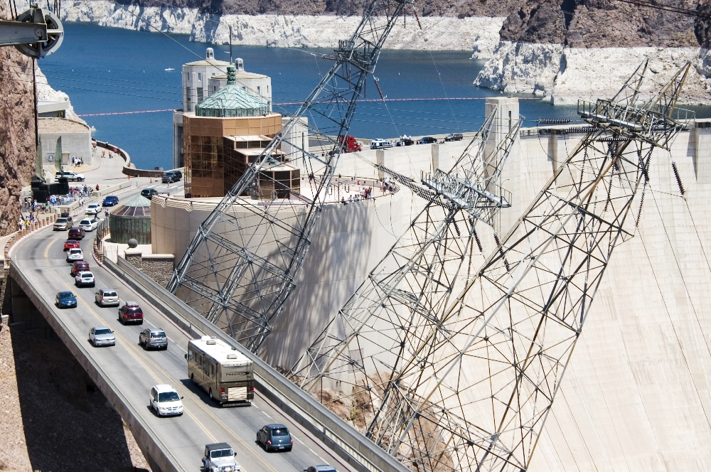
* Traffic across the dam: 13,000 to 16,000 people each day, according to the Federal
Highway Administration
* Lake Mead (full pool)
* area: 157,900 acres (639 km²), backing up 110 miles (177 km) behind the dam.
* volume: 28,537,000 acre feet (35.200 km³) at an elevation of 1,221.4 feet (372.3 m) .
* With 8 to 10 million visitors each year, including visitors to Hoover Dam but not all traffic across the dam, the Lake Mead National Recreation Area is the fifth busiest National Park Service area.
Read more...